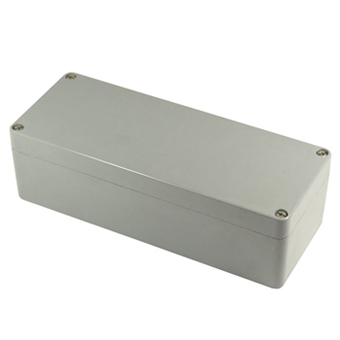
Rock
The FALCOM ROCK is a stand-alone tracking device that can be used for both mobile and fixed asset management. The device concept combines the latest quad-band GSM/GPRS technology for communication, a high-sensitive GPS receiver for positioning, a waterproof compact case, and a durable internal battery pack for long-life operation eleminating the need for an external power source. The internal long-life 13.000 mAh battery pack providing over three years of autonomous operation (depending on reporting interval). This is an ideal solution for managing and tracking containers, trailers, trains, and high-value assets where no power source is present. Many features and new firmware can be downloaded over-the-air helping you to manage your mobile and fixed assets, provide better customer service, reduce costs and increase profits.
This unit is shipped preconfigured from the factory with simply functions and GPS position reports. This data can be polled periodically or remotely on demand. A detailed GPS report includes NMEA 0183 GPRMC, which shows position data in the form of UTC, Latitude, Longitude, Altitude. This integrated report also contains GSM net code and base station code, helping locate the position of container or asset when a GPS signal is not available. After a predifined time out or no movement, tracker reports current position and automatically shuts down, saving all battery power until next time out, incoming call, SMS or motion. When next motion is detected or timer runs out, or call or SMS is received the unit wakes up and reports new GPS position within 2 minutes.
- Quad-Band GSM/GPRS technology for 2-way communication
- High-sensitity GPS receiver for positioning
- Embedded TCP/IP stack for client-server application
- Stand-alone tracking device needing no external power supply
- Highly durable IP69 waterproof and shock-resistant case
- Easy installation and Minimal maintenance
- Compact, low-cost and low power unit
- Very-efficient power saving modes
- 5xLR20 internal battery pack for long-life operation
- Up to 3* years operation without replacing the battery pack
- Remote activation, configuration, administration and over-the-air firmware upgrade
- Customized reports and sending intervals
- Custom housing and packaging design possible


 To the top