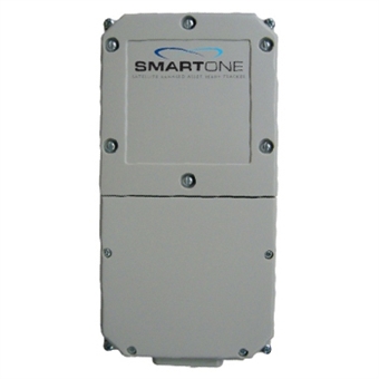
SmartOne LP
Designed for the intelligent management of powered and non-powered ἀxed and mobile assets, the SmartOne LP (line-powered) is a practical solution for tracking asset location, reporting unauthorized movement, engine runtime reporting and major fault monitoring as well as a multitude of other applications. Track intermediate bulk containers, vehicles and boats as a solution to improve your assets operating efἀciency and security.
The SmartOne LP can be line-powered (operates on external power) or in the absence, interruption or failure of line-power, the SmartOne LP will automatically switch to battery back-up to ensure transmissions continue. When using line-power, the user has maximum flxibility in messaging frequency allowing for regular monitoring of asset location.
The SmartOne LP utilizes motion sensors, comparative GPS positions and custom configured sensos to gather and transmit asset status information. Each SmartOne LP is configured to trak its asset’s specific needs and prvide intermediate and emergency alerts by email or text (VAR software integration required).
- Quick installation: Use industrial adhesives, brackets or screw mounts for installation
- Simple packaging: Requires no harnesses, external power or external antenna
- Automatic alerts: Change of location sensing sends alerts if asset moves outside of pre-determined range
- Messaging cost reduction mode: Reduced satellite messaging if asset remains in same location for a pre-determined period of time
- Hardware on/off feature: Allows the unit to initiate GPS re-centering functionality
- Accepts serial signals (TTL) from external inputs
- Operates on external line power from 10 to 48 volts DC
- “Asset-ready” design: Allows for easy installation and field management without the need or antennas or external power
- Standard Messaging includes: Wake, GPS locate, transmit location, resume sleep and additional 12 programmable sleep and time-of-wake settings
- Messaging Cost Reduction Feature: Reduces satellite messaging if asset remains in same location or cannot obtain a GPS fix (indoors)


 To the top